Copyright The British Library Board. 3
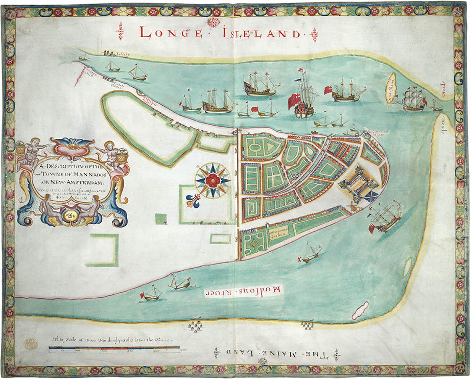
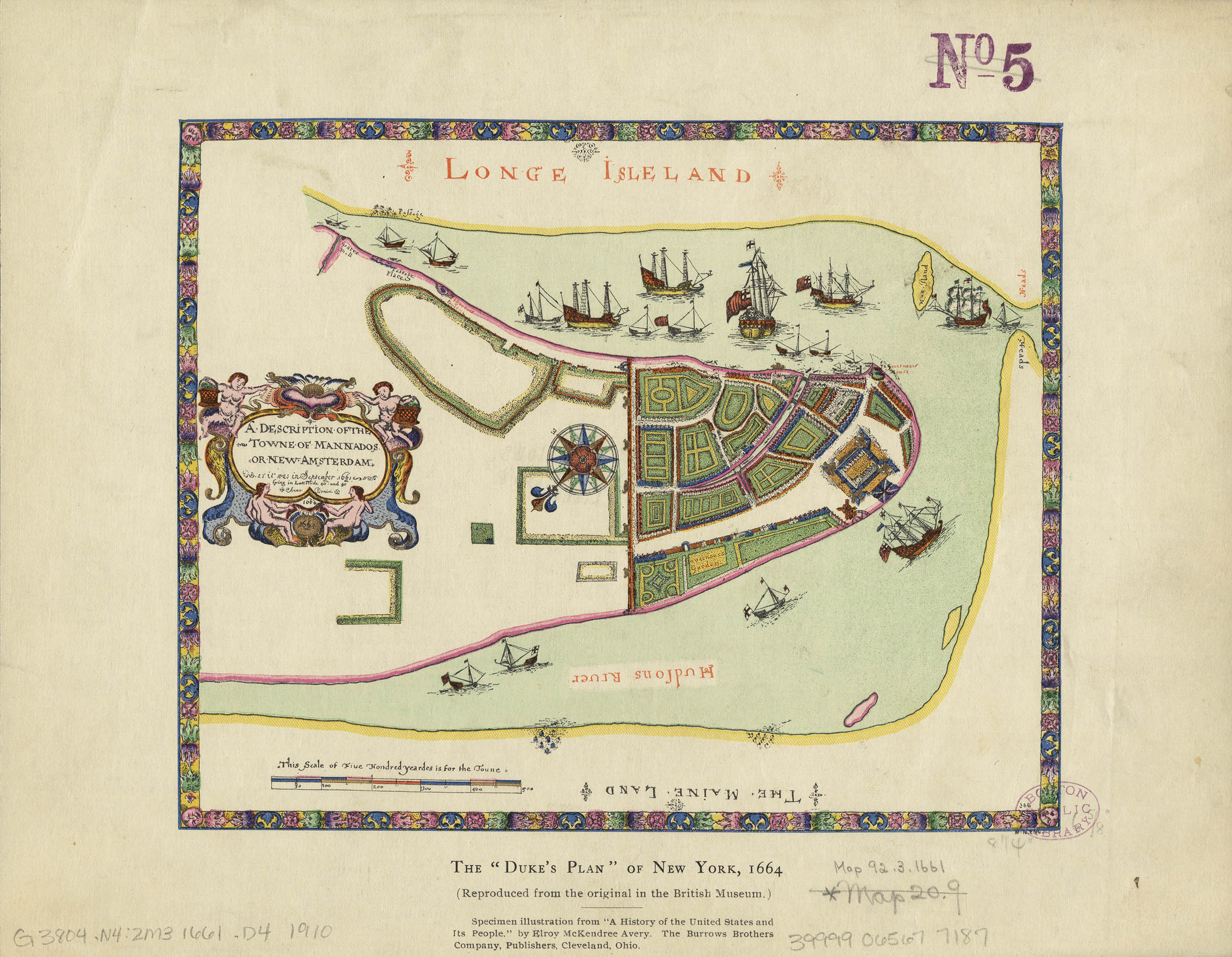
The Duke’s Plan
A Description of the Towne of Mannados or New Amsterdam
Anonymous, 1664
After the English Restoration in 1660 Charles II, from the House of Stuart, became king. His younger brother James II became the Duke of York and Lord High Admiral. In 1664 Charles granted James all of the American territory between the Delaware and Connecticut Rivers.1 Of course directly in the middle of this land grant was New Amsterdam. Charles, however, vowed to “bring all his Kingdoms under one form of government, both in church and state, and to install the Anglican government as in old England.”
At his own expense James sent a flotilla of warships to capture the Dutch colony. On 27 August 1664 four frigates with some 450 soldiers under the command of Richard Nicolls entered New York Harbor, demanded Stuyvesant’s surrender and promised the settlers that they could “peaceably enjoy whatsoever God’s blessing and their own honest industry have furnished them with and all other privileges with his majesty’s English subjects.”
Stuyvesant intended to resist, but badly outnumbered and with no support from either the WIC or his own citizenry he was forced to surrender. On 8 September 1664 he boarded a ship back to Amsterdam.
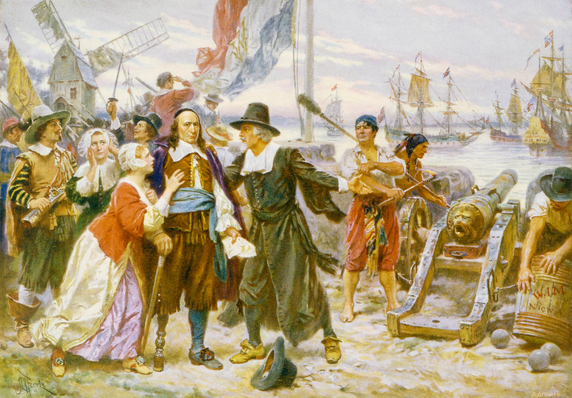
Leon Ferris, The Fall of New Amsterdam. From a 1932 postcard. Library of Congress
It took two more Anglo-Dutch wars to sort this all out but in the end the Dutch relinquished their claim. New Amsterdam under the control of the WIC became New York under the control of James II.
The source of the map, which claims to show the city “as it was in September 1661” was most likely the survey of Jacques Cortelyou, although other historians have suggested William Hack, Augustine Herrman or even an English spy living amongst the Dutch.
The map itself, a 27¼ × 21¾" ink and watercolor on vellum manuscript, was prepared in 1664 by one of the decorative chart makers near the Tower of London – a master of the Thames School – and may have accompanied the town's request to the Duke of York for his patronage.2 It entered the royal collections and was presented to the British Museum in the 1820s by George IV. It is now part of the King’s Topographical Collection in the British Library.3
It was found in 1858 by George Moore, librarian of the New York Historical Society, who named it “the Duke’s Plan.” A lithographic reproduction was included in the next edition of the Valentine’s Manual and was copied by Henry Dunreath Tyler, ca.1890: 4
The 1890 lithograph, Harvard Map Collection
The bird’s-eye view shows all of the city south of the wall and some of the lots north as well as settlements on Long Island and New Jersey. English names replace those of the Dutch: e.g. Stuyvesant’s house, which would eventually be named Whitehall is listed here as the Governours House. Finally the English ships in the harbor emphasize their victory over the Dutch. It is the first English map of New York and in many ways the last Dutch one.
26 December 2013
1. For an overview of the English colonies see: Doyle, John. English Colonies in America. New York: Henry Holt, 1882–1907. (5 vol) (online).
2. For more about the Thames School see: Pedley, Mary. The Commerce of Cartography: Making and Marketing Maps in Eighteenth-century France and England. Chicago: University of Chicago Press, 2005 (WorldCat).
3. British Library Maps.K.Top. CXXI.35 (online).
4. Valentine, D.T. Manual of the Corporation of New York. New York: Chas. Baker, 1859 (online).