
Geological Atlas of the United States
Frederick Merrill/USGS, 1902
The earliest bedrock in New York City – the metamorphic Fordham Gneiss – was formed some 1.2 billion years ago during the tectonic upheaval that created the super-continent Rodinia. Later (~500 Ma), when a volcanic island chain collided with the eastern edge of the paleocontinent Laurentia a layer of metamorphosed sea sediments – the Manhattan and Hartland Schists – were folded in. Finally (~450 Ma) another layer of metamorphosed sediments – the Inwood Marble – was deposited on the continental shelf of what would become North America.
These layers of rock were then shaped by a succession of Pleistocene-era glaciers. The last of these – the Wisconsin Ice Sheet – advanced as far south as Staten Island leveling hills and bluffs, carving river valleys and sea basins and in places scouring the soil cover down to the ancient gneiss and schist. When it receded some 11,000 years ago it left behind enough till and outwash to create parts of Brooklyn and nearly all of Long Island.1

Manhattan Schist + hippy girl in Central Park. Dave Hughes, Oct 2011
This glacial topography would be radically altered and the bedrock would form the foundation for one of the most densely populated and tallest cities in the world, but that part of the story is still several thousand years off.
Frederick Merill (1861 – 1916) studied geology at Columbia and in 1894 became the director of the New York State Museum and later the State Geographer. Among his many geological maps of the state was the 1901 Hypsometric Map of New York State, 1:760,320, which he called “a graphic espression of the general results of the geologic study of the rocks of the state.” As the historian David Allen notes more recent geological maps are simply revisions of Merrill’s 1901 map.2
The Geological Atlas of the United States – one of the original mandates of the USGS – was issued in 227 folios between 1894 and 1945.3 The New York City folio used the 15 minute (1:62,500 scale) quadrangles from the 1888–89 U.S. Coast and Geodetic Survey as the base map and added the geological information from Merrill’s 1901 geological survey. It was the first detailed map of the city’s geology. The map above is a mosaic of the four quadrangles from the folio:
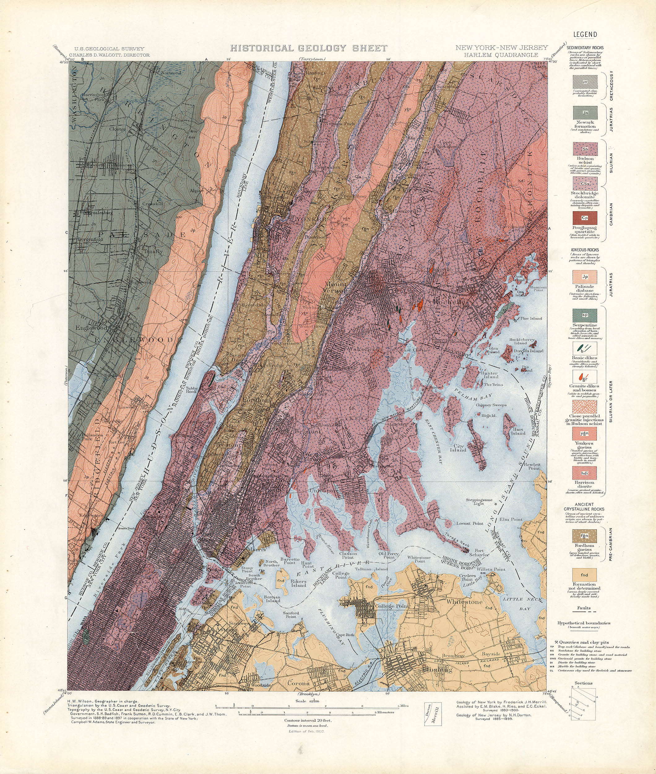
The Harlem quadrangle. Texas A&M Library
13 August 2013
1. For some geological background see: Isachsen, Yngvar. Geology of New York: A Simplified Account. Albany: New York State Museum, 2001 (WorldCat).
2. For an early history of geological mapping of the state see: See: Merrill, Frederick. Description of the State Geologic Map of 1901. Albany: University of the State of New York, 1902 (online).
3. For a detailed description of the Altas see: Willis, Bailey. The Development of the Geologic Atlas of the United States. Journal of the American Geographical Society of New York. 1895; 27(4): 337–351 (online).